Swimming Holes & Waterfalls Near Ludlow, Okemo & the Black River Valley, Vermont
Okemo-area Vermont freshwater: Buttermilk Falls on Falls Brook, Black River Falls, Camp Plymouth Echo Lake beach, West Hill Recreation Area, and Cavendish Gorge on the Black River—each with a linked guide and map pin.
Map of the picks
Ludlow is the Okemo town name people remember. Falls Brook and the Black River are the cold-water facts behind the postcards. This planner keeps swim pages and falls pages in one list because that is how July actually runs: someone wants ledges, someone else wants sand, and rain yesterday rewrote both.
Links below go only to guides on this site. They do not replace town notices, utility posting near Cavendish, or your own thunder judgment.
- Buttermilk Falls — Ludlow, VT
- Camp Plymouth State Park Swim Beach — Ludlow, VT
- Black River Falls — Ludlow, VT
- West Hill Recreation Area — Ludlow, VT
- Cavendish Gorge — Cavendish, VT
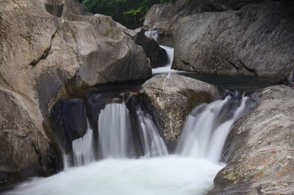
Buttermilk first — brook ledges with real walk time
Buttermilk Falls is the tiered-pool stop people mean when they say “Okemo swimming hole.” Read walk distance, roadside parking honesty, and cold water notes in the guide—August sun does not make June temperatures a lie.
Echo Lake — the beach-and-picnic anchor
Camp Plymouth is the state-park answer when Buttermilk parking or morale fails the group test. It is also the right vocabulary when someone says “lifeguard culture” even if this site still expects you to read posting yourself.
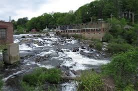
Black River Falls — shorter look, heavier caution
Black River Falls behaves like a waterfall-first page on the place page. Use it when you want moving water scenery without pretending you are at a quarry.
West Hill — town recreation vocabulary
West Hill Recreation Area is filed as a swimming-holes guide with town framing. Match the pin to what you see at the kiosk the day you arrive—hours and rules change with season and budget cycles.
Cavendish Gorge — same valley, different posting story
Cavendish Gorge belongs in the Black River mental map, not inside Ludlow city limits. The guide carries utility and access language you should read before you promise kids a gorge day.
Stewardship
- Roadside: never block farm gates or mailboxes—rural EMS routes are narrow.
- River: pack it out; glass and cigarette butts show in sand the same afternoon.
- Noise: valley acoustics carry—keep music at the car window, not the beach line.
Related guides
- Waterfalls & Swimming Near Killington, Rutland & Lake Bomoseen, Vermont — Route 100 north picks when Ludlow is only the first leg.
- Waterfalls & Swimming Holes Near Woodstock & Quechee — Upper Valley loop options on a different map.
Updated June 1, 2026