Best Swimming Holes Near Springfield and the Pioneer Valley
Freshwater swimming near Springfield and the Pioneer Valley, including nearby lake beaches, Amherst-area ponds, and westward hilltown backups.
Map of the picks

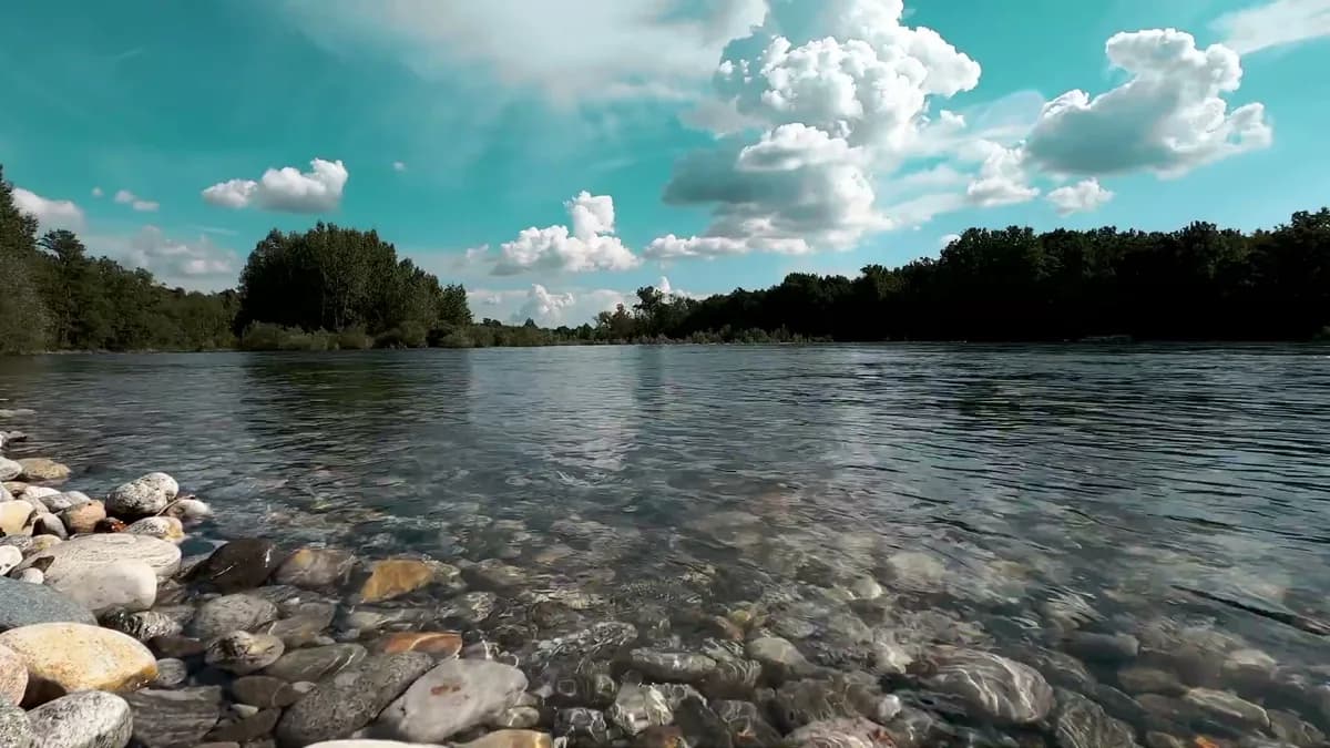
Springfield and the Pioneer Valley get hot in a way that makes water searches urgent. The mistake is sending every searcher to a gorge when many of them need a pond, a beach, or a simple after-work swim. This page should connect Springfield, Amherst, Northampton, Westfield, and the hilltowns without pretending they are all the same kind of day.
Quick answer
| Question | Best answer |
|---|---|
| Best near Springfield | Hampton Ponds. |
| Best Amherst-area pick | Puffer's Pond. |
| Best hilltown family backup | DAR State Forest / Upper Highland Lake. |
| Best scenic add-on | Chesterfield Gorge, as a look-first stop. |
| Best wider backup | Burr Pond or Lake Waramaug if heading south or west. |
How to use this guide
Use this as a first-stop and backup-stop planner. Massachusetts swim days are often decided by parking, town rules, and water-quality postings before they are decided by scenery. Pick the practical stop first, then add the prettier detour if the day still has room.
Separate beach days from gorge stops
A beach day solves heat. A gorge stop adds scenery. The article should help readers choose the right category first.
Use I-91 logic
People will search from Springfield, Northampton, Amherst, and Hartford. Internal links should make those corridors clear.
The picks
1. Hampton Ponds - Westfield, MA
Hampton Ponds is the first practical answer for Springfield-area searchers who want nearby freshwater and a real beach setup.
- Best for: Springfield-area freshwater without driving deep into the hills
- Watch for: DCR status, beach crowding, and water-quality posting
Open the Hampton Ponds guide.
2. Puffer's Pond - Amherst, MA
Puffer's usually belongs in the conversation when the northern rivers still feel sharp. It is a pond day, not a wilderness day, and that is exactly why it converts searchers.
- Best for: warm-feeling Pioneer Valley water and college-town summer energy
- Watch for: posted water-quality notices, limited parking, and hot-afternoon crowds
Open the Puffer's Pond guide.
3. DAR State Forest / Upper Highland Lake - Goshen, MA
DAR gives the Pioneer Valley page a strong north-and-west backup when Springfield heat pushes people toward elevation.
- Best for: hilltown lake swimming and an easier family backup north of Northampton
- Watch for: state forest fees, seasonal staffing, and cool hilltown water
Open the DAR State Forest / Upper Highland Lake guide.
4. Burr Pond State Park - Torrington, CT
Burr Pond is the kind of place that saves a messy summer plan. It has a real park structure, a simple beach rhythm, and a good role after rain when rivers should wait.
- Best for: Connecticut families, June water, and a managed pond-beach setup
- Watch for: posted beach status, seasonal staffing, and full lots on hot weekends
Open the Burr Pond State Park guide.
5. Lake Waramaug State Park - Kent / New Preston, CT
Lake Waramaug is a gentler Litchfield Hills swim answer when waterfalls are too posted, too cold, or too slippery after rain.
- Best for: quiet family lake days in the Litchfield Hills
- Watch for: state park rules, seasonal fees, and warm-weekend crowding
Open the Lake Waramaug State Park guide.
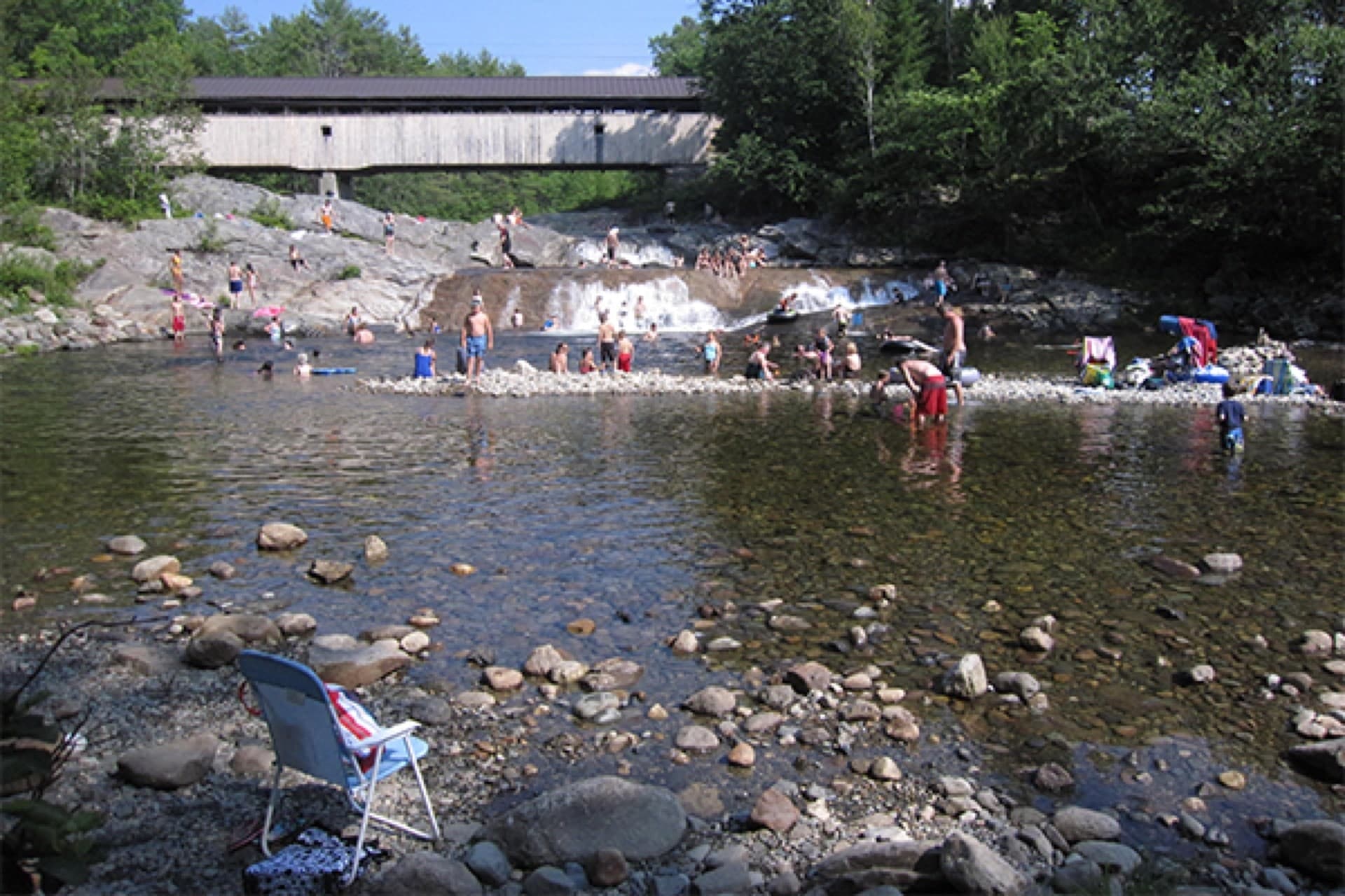
6. Chesterfield Gorge - Chesterfield, MA
Chesterfield Gorge belongs as a sound-and-scenery stop. Do not sell it as the family swim beach.
- Best for: scenery, mist, and a Westfield River corridor add-on
- Watch for: no-swim or look-first context, fast water after rain, and slick stone
Open the Chesterfield Gorge guide.
7. Umpachene Falls - New Marlborough, MA
Umpachene is the kind of Berkshire stop people picture: shaded water, picnic energy, and enough structure to be useful if the rules are respected.
- Best for: a southern Berkshire swim-and-falls day when local rules allow
- Watch for: town day-use rules, nonresident fees, and slick rock
Open the Umpachene Falls guide.
8. Waterbury Center State Park Swim Beach - Waterbury Center, VT
Waterbury Center gives Vermont travelers a practical beach-style pivot before committing to narrow gorge pools. It feels local, but it does not ask the group to scramble over slick rock.
- Best for: Stowe and Burlington visitors who want a calmer reservoir backup
- Watch for: state park fees, wind, posted water status, and reservoir boat traffic
Open the Waterbury Center State Park Swim Beach guide.
Before you go
- Check the latest rain, not just the current sky.
- Read posted signs at the water, even if the guide looked good the night before.
- Do not assume lifeguards are present just because a beach is open.
- Keep a second pick within 20 to 45 minutes whenever possible.
- Leave roadside shoulders, private driveways, gates, and emergency access clear.
- Pack out trash, keep the noise down near homes, and treat local swim spots as borrowed space.
Related guides
- Springfield and Westfield River swimming guide
- Swimming holes near Amherst and Northampton
- Start with the full New England Swimming Holes map
- Browse all New England guide articles
- Browse Massachusetts swimming holes
- Browse New Hampshire swimming holes
- Browse Vermont swimming holes
FAQ
Which place should I start with?
Start with Hampton Ponds if it matches your drive and group. Then keep Puffer's Pond in reserve in case parking, water quality, or rain changes the day.
Are these swimming holes good after rain?
Not always. After heavy rain, choose managed lake or pond beaches first and avoid narrow gorges, fast rivers, and slick ledge pools until water is clear, flow is settled, and posted rules support swimming.
Which pick is best for families?
For most families, start with the most managed beach-style option on this list, not the most dramatic gorge. Bathrooms, clear entry, and easy exits usually matter more than the most dramatic photo.
Updated 2026-06-01
Updated June 1, 2026