New England
Swimming Holes
New England
Swimming Holes
Browse
Map
Published guides
Search guides
State
New Hampshire
394
Vermont
411
Maine
748
Massachusetts
477
Rhode Island
112
Connecticut
370
Category
Waterfalls
1,393
Swimming holes
907
2300
guides match your filters.
Showing 20 of 2,300. Use
Show more
for the next batch.
One list of places matching your filters. Open a row for the full guide.
Preview
Place
State & type
Open
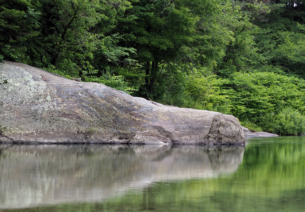
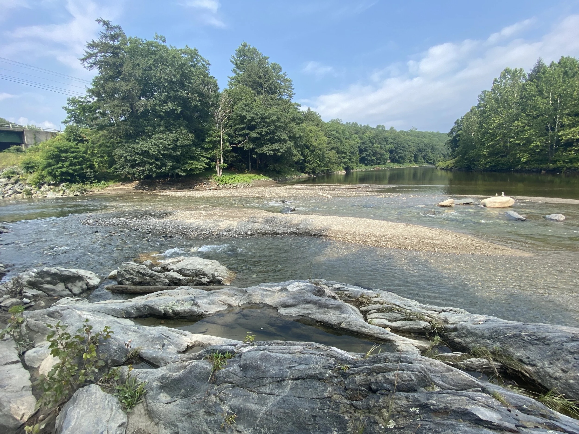
Vermont · Swimming holes
Lareau Swim Hole
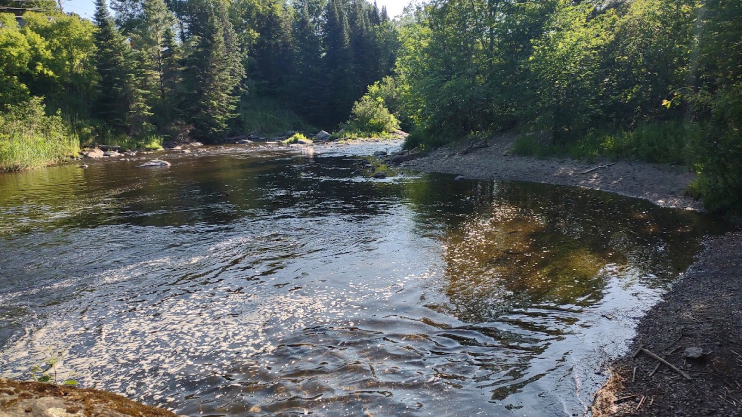
Mad River off Route 100 near Waitsfield—short approach, cold water, mixed waders and jumpers, busy fair weekends.
Waitsfield, Vermont
Vermont · Swimming holes
→
Vermont · Swimming holes
Dog River Jacuzzi Natural Area
Route 12 fire department parking—short bank walk to a compact Dog River plunge pool; USGS trend is same river, not pool depth.
Berlin, Vermont
Vermont · Swimming holes
→
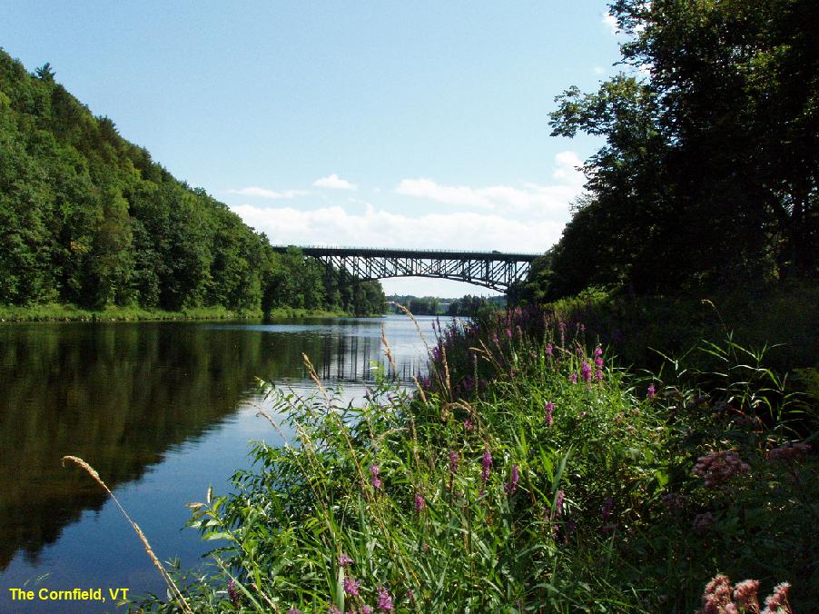
Vermont · Swimming holes
The Cornfield Swimming Hole
Informal Route 30 West River pull-off after I-91—wide gravel bar; USGS is below Townshend Dam, not depth here.
Brattleboro, Vermont
Vermont · Swimming holes
→
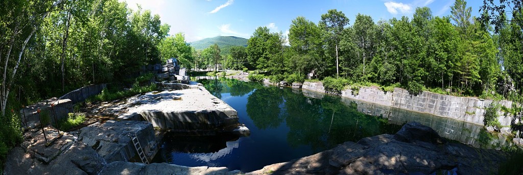
Vermont · Swimming holes
Dorset Quarry
Flooded marble quarry on Route 30—waiver, seasonal hours, cold deep water; no USGS gauge for the pool.
Dorset, Vermont
Vermont · Swimming holes
→
Vermont · Swimming holes
Mad River Path – West Greenway
Meadow Road trailhead—multi-stop Mad River greenway; USGS Moretown trend is valley-wide, not depth at one entry.
Waitsfield, Vermont
Vermont · Swimming holes
→
Vermont · Swimming holes
Four Corners Swimming Hole
Bugbee Brook at VT-101 Four Corners—dirt lot across from Jay cluster; USGS Missisquoi is basin trend, not pool depth.
Troy, Vermont
Vermont · Swimming holes
→
Vermont · Swimming holes
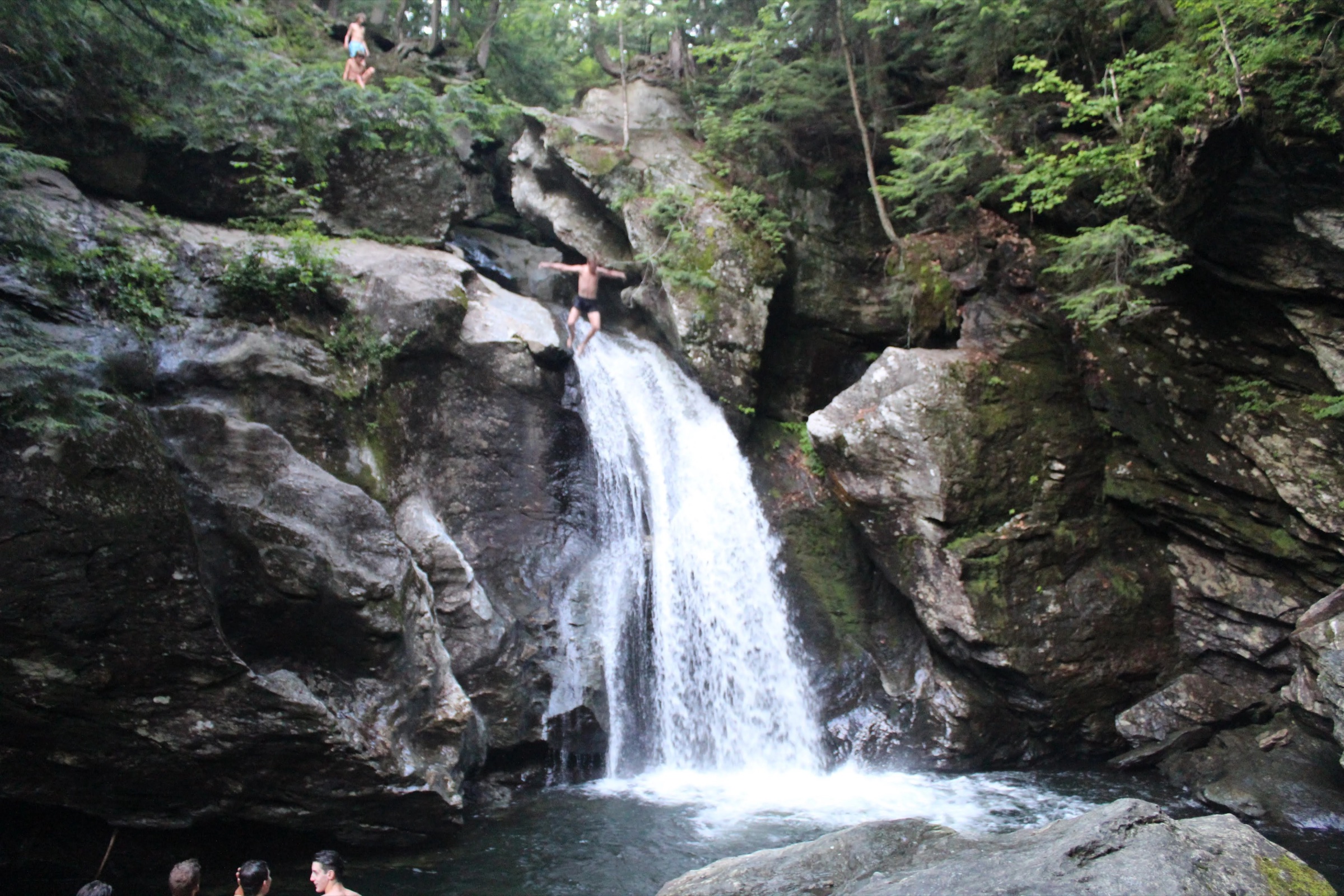
Foster’s Hole
Roadside pull-off on Notch Brook Road, short stone steps down to the pool.
Stowe, Vermont
Vermont · Swimming holes
→
Vermont · Swimming holes
Gold Brook Swimming Hole
Small pool under the Gold Brook Road bridge, parking off Route 100.
Stowe, Vermont
Vermont · Swimming holes
→
Vermont · Swimming holes
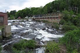
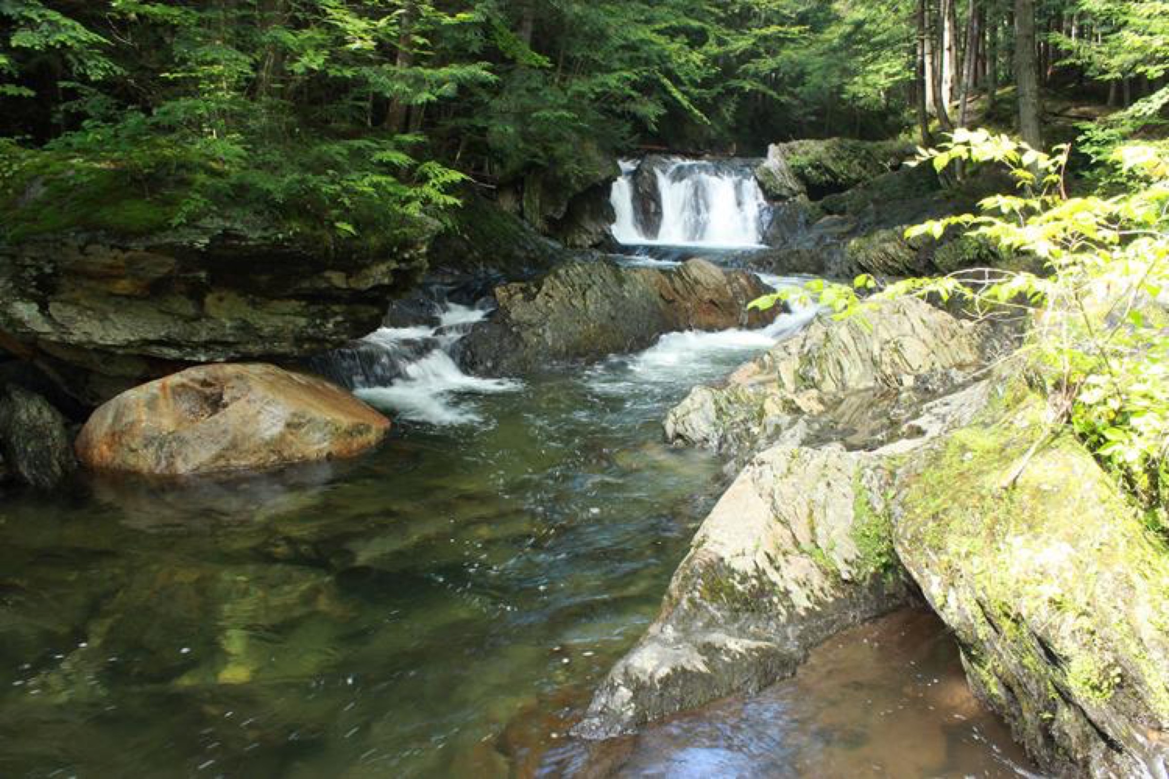
Cady Falls Swimming Hole
Shallow cascades and ledges on the Lamoille at Morrisville’s Cadys Falls reach.
Morrisville, Vermont
Vermont · Swimming holes
→
Vermont · Swimming holes
Rock River Swimming Holes
Route 30 pull-offs near Depot Road—multi-stop Rock River corridor; rockrivervt.com; no USGS merge on this guide.
Newfane, Vermont
Vermont · Swimming holes
→
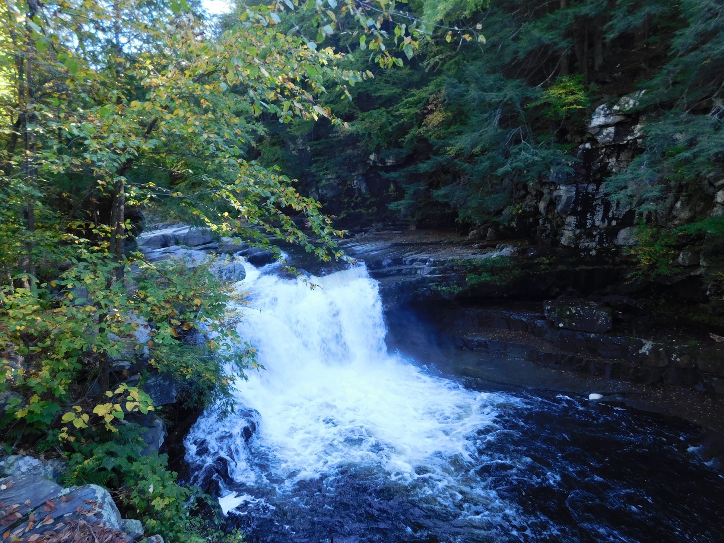
Vermont · Swimming holes
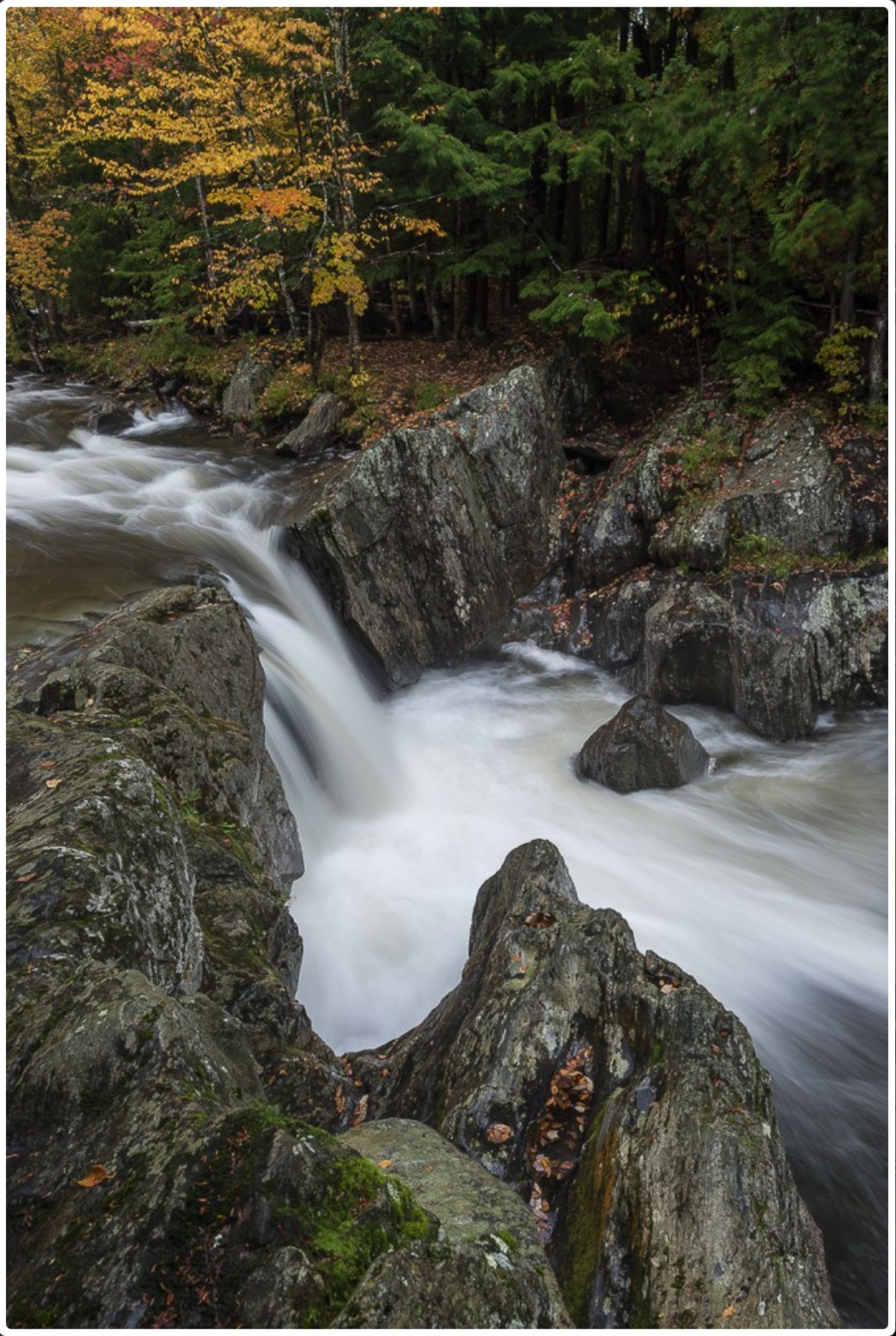
Bristol Falls
Lincoln Gap Road New Haven River context—same river as Bartlett Falls. waterfall guide; USGS 04282525 is Brooksville main-stem proxy, not gorge pool depth.
Bristol, Vermont
Vermont · Swimming holes
→
Vermont · Swimming holes
Bolton Potholes
Joiner Brook potholes—no legal car parking at the site per VRC/Bolton docs; USGS 04286000 is Winooski at Montpelier proxy only, not flow inside the…
Bolton, Vermont
Vermont · Swimming holes
→
Vermont · Swimming holes
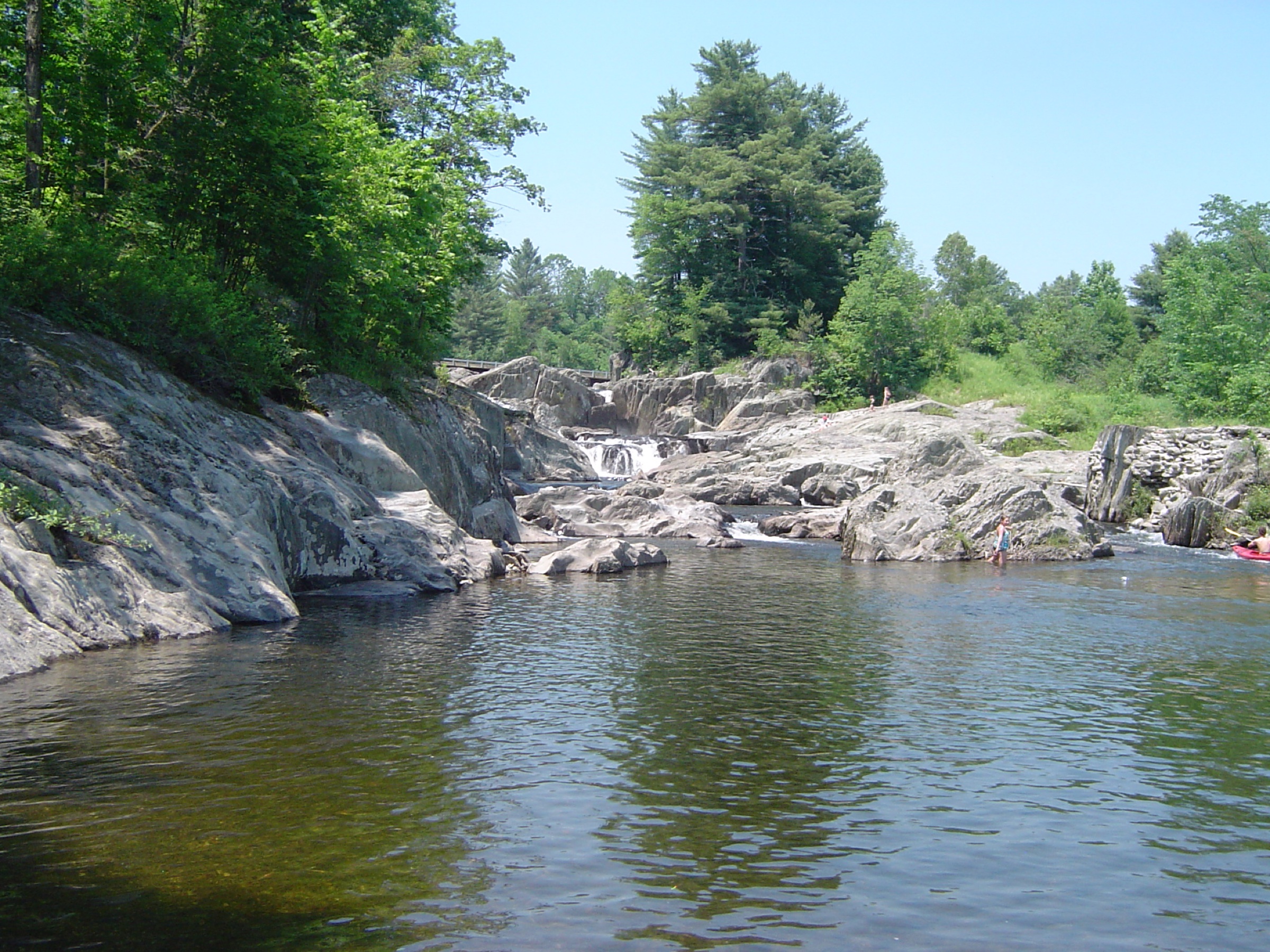
Salmon Hole (West River)
Jamaica State Park beach on the West River—USGS 01155500 is the same town reach as the published gage note; not depth at your feet.
Jamaica, Vermont
Vermont · Swimming holes
→
Vermont · Swimming holes
Wrightsville Reservoir
District-managed Wrightsville Beach on the impoundment—Tier A NWS only on this row; watch boats, wind chop, and cold open water rather than a river cfs…
Middlesex, Vermont
Vermont · Swimming holes
→
Vermont · Swimming holes
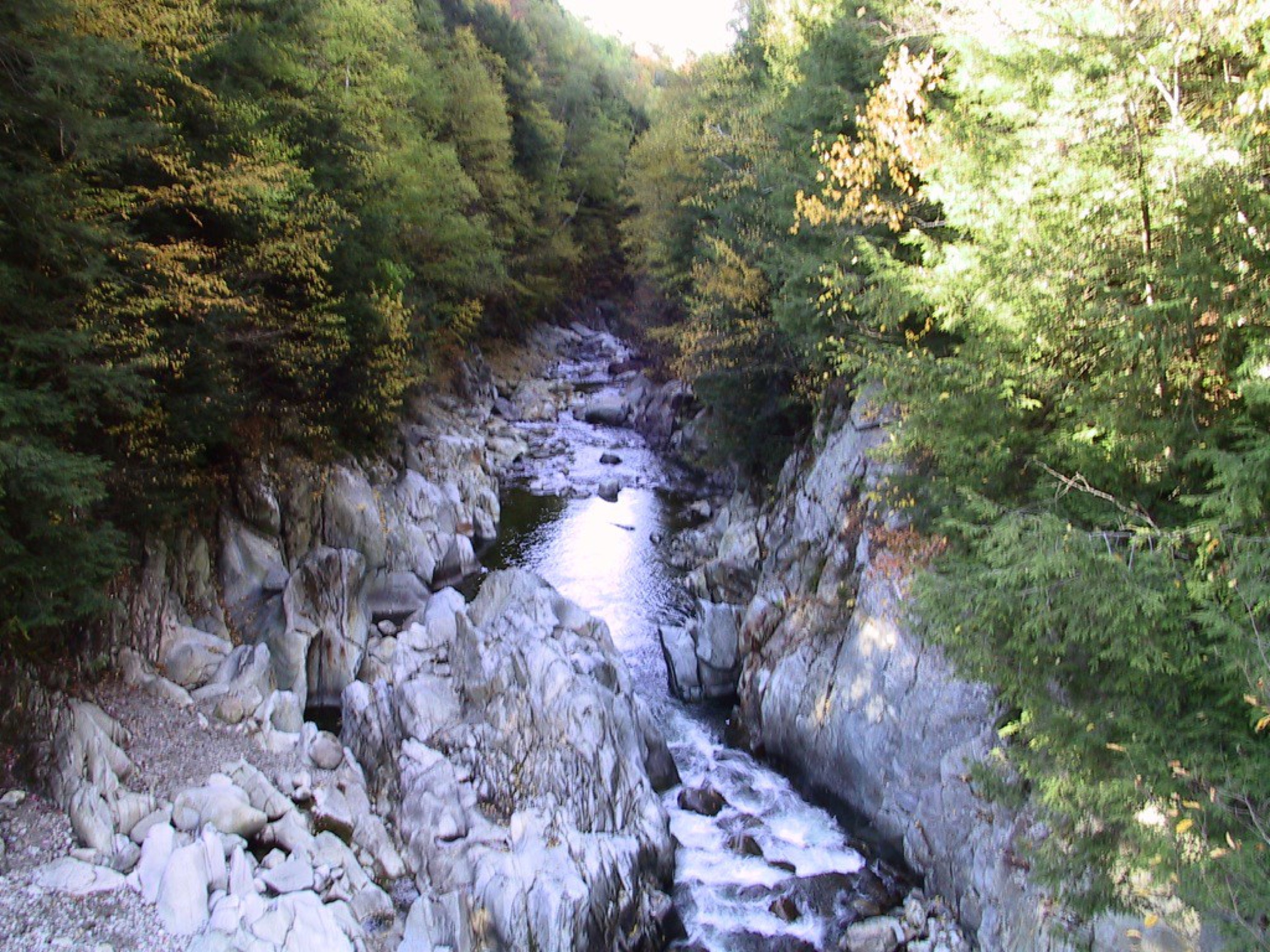
East Middlebury Gorge
VT-125 Otter Creek gorge context—swim not recommended in guide copy; USGS 04282500 is basin proxy only, not pool depth inside the gorge.
Middlebury, Vermont
Vermont · Swimming holes
→
Vermont · Swimming holes
Clarendon Gorge
Lower Clarendon Gorge on FPR land—swim not recommended in guide copy; USGS 04282500 downstream proxy only, not turbulence inside gorge pools.
Clarendon, Vermont
Vermont · Swimming holes
→
Vermont · Swimming holes
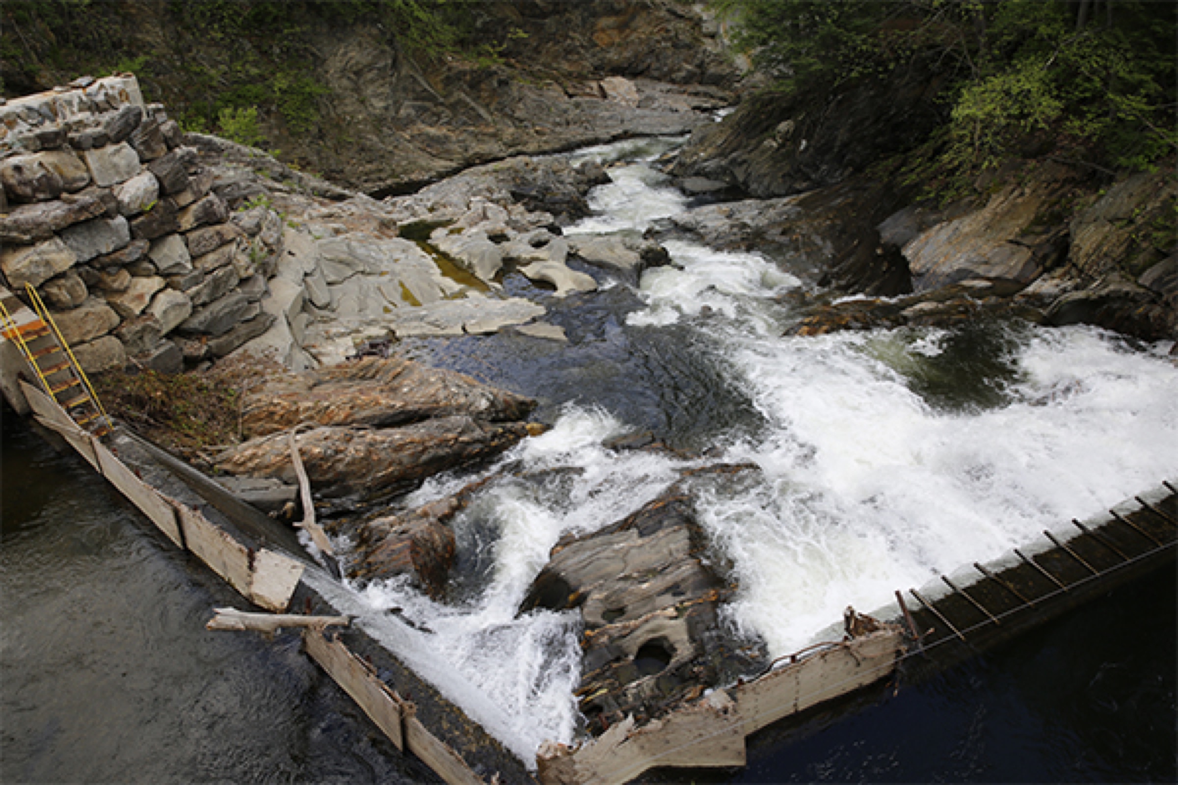
Cavendish Gorge
Black River gorge near Route 131—USGS 01153000 is North Springfield upstream proxy; dam and utility corridors add hazard beyond any graph.
Cavendish, Vermont
Vermont · Swimming holes
→
Vermont · Swimming holes
Brockways Mills Gorge
Brockways Mills Road lot at Williams River dam reach—USGS 01153550 is near Rockingham on the same river; secondary catalog coordinates keep the gage pin…
Rockingham, Vermont
Vermont · Swimming holes
→
Vermont · Swimming holes
Beard Recreation Park
A giant Gihon pool with gradual entry, on-site parking, and one of the easiest family access setups in Vermont.
Johnson, Vermont
Vermont · Swimming holes
→
Vermont · Swimming holes
Journey's End Swimming Hole
Protected Foote Brook access with a short walk, shade, and a scout-first stream feel.
Johnson, Vermont
Vermont · Swimming holes
→
Show more (20 next)