Freshwater Swimming Near the Belgrade Lakes, Waterville & Augusta, Maine
China Lake and Lake St. George state-park beaches, Great Pond and Messalonskee stream access, McGrath Pond, The Cascade at Oakland, plus Ticonic and Augusta Falls—central Maine on one map.
Map of the picks
Central Maine’s Belgrade chain is where families, anglers, and cabin renters stack summer weeks: long lake views, boat wakes on busy afternoons, and stream mouths that can feel like a private cove one day and a parking puzzle the next. Waterville and Augusta add Kennebec River drama—big water, industrial history, and falls pages that deserve waterfall-first reading even when the photos look inviting.
Use this guide to sequence a day: pick one primary lake beach, keep a second access point in your pocket for wind or algae notices, and treat urban falls as short stops unless the place guide clearly supports more.
- China Lake State Park (China) — China, ME
- Lake St. George State Park — Liberty, ME
- Great Pond (Belgrade) — Belgrade / Rome area, ME
- Messalonskee Lake (stream beaches) — Belgrade / Oakland, ME
- McGrath Pond (Belgrade/Oakland area) — Rome / Oakland area, ME
- The Cascade — Oakland, ME
- Ticonic Falls — Waterville, ME
- Augusta Falls — Augusta, ME
How to read this cluster
- State-park beaches give the most predictable parking-and-rules story for visitors from away.
- Chain-lake sandbars and town beaches trade polish for flexibility—fees, stickers, and neighbor context show up fast.
- Waterfall pins on the Kennebec are often about ledge hydraulics and urban bank posting, not rope swings.
1–2. China Lake & Lake St. George — state-park swim anchors
China Lake State Park and Lake St. George State Park are the two clearest DIF-style pages in this planner: managed swim culture, maintained access, and enough on-site guidance to plan a cooler full of food without guessing at a boat ramp.
They are not interchangeable geography—China sits west of the Belgrade village cluster; Lake St. George anchors a Liberty day when you want forested shoreline framing. Open both guides if your group splits between “closest to Route 3” and “closest to the coast road home.”
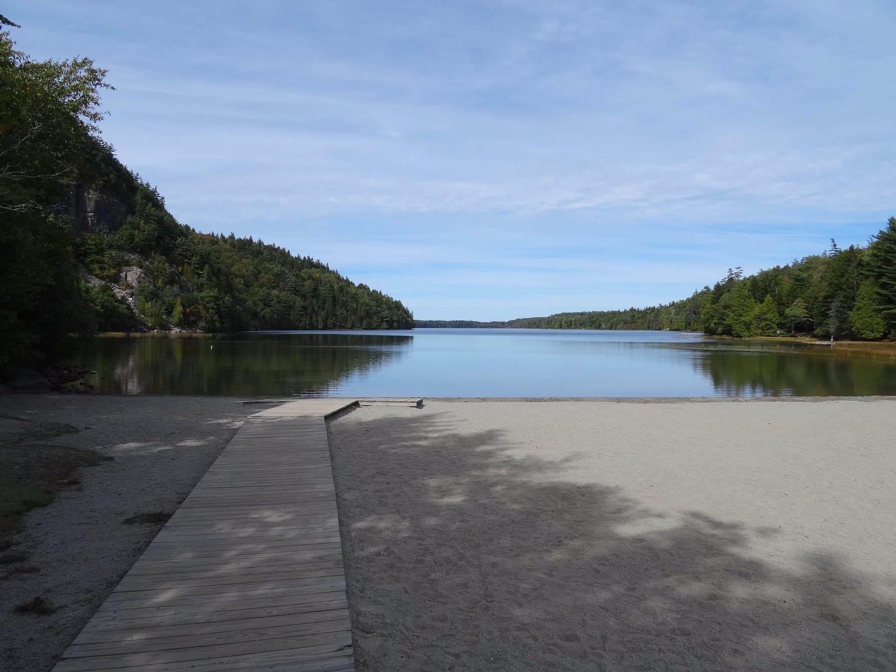
3–5. Great Pond, Messalonskee, McGrath — chain-lake strategy
Great Pond and Messalonskee are big water with multiple public touch points. That is a strength for wind shifts—you can sometimes move to a lee shore—but it is also a crowd and wake story on Saturday.
**McGrath Pond is intentionally smaller. The write-up asks you to verify public-landing language; treat it as a scout-first pond stop for quieter water, not as a default when Great Pond’s lots are full unless you have read the access notes.
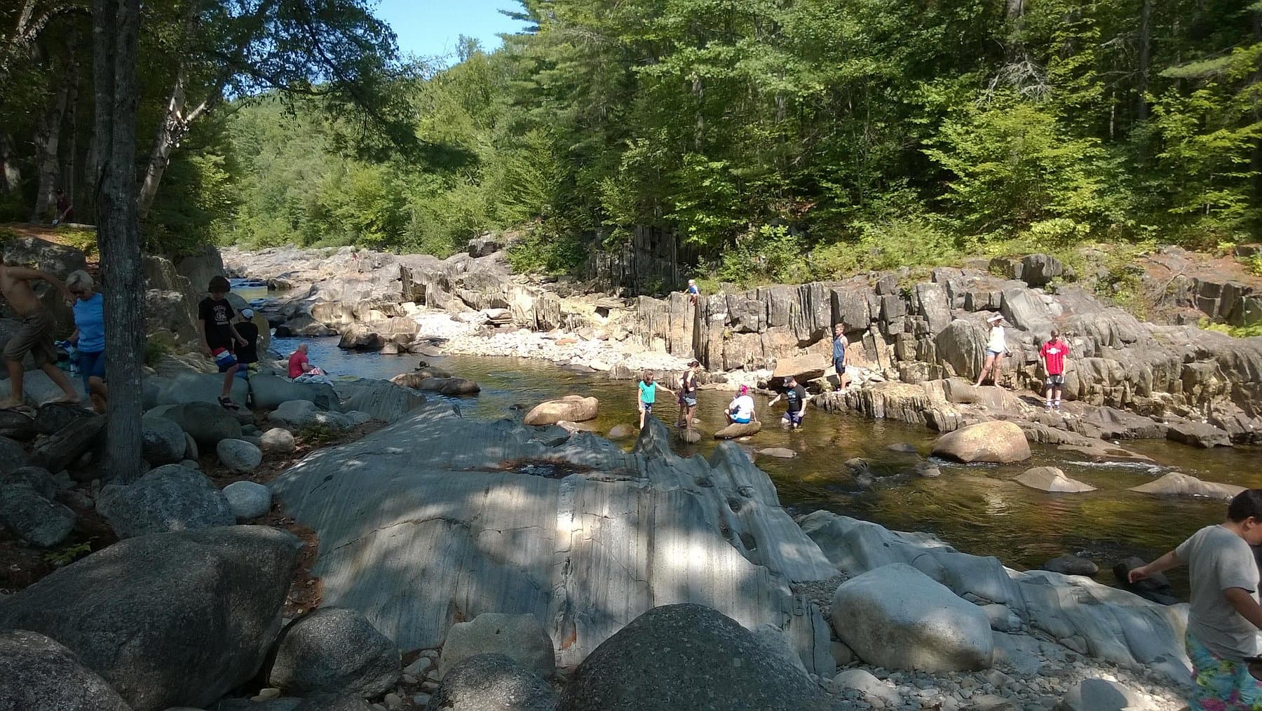
6. The Cascade (Oakland) — brook waterfall with swim notes on the place page
The Cascade in Oakland is filed as a waterfall with swimming allowed in overview facts—unusual enough that you should still read the full guide before you treat it like a quarry. Brook volume changes quickly; slick shelf rock is a recurring theme in similar Maine entries.
7–8. Ticonic and Augusta Falls — river drama without promising a swim beach
Ticonic Falls in Waterville and Augusta Falls in Augusta are Kennebec corridor waterfall pages. The site’s default framing is swimming not recommended: currents, ledges, and unpredictable urban bank access all matter.
They stay on the map because people actually drive through Waterville and Augusta for the Belgrade chain. Use them as a short add-on: mist, photos, ice cream in town, then back to a lake beach when the swim notes match your group.
Wind, algae, and motorboats — practical sequencing
- Morning lake swims often beat afternoon chop when boat traffic peaks.
- Northwest wind can make one shore unpleasant and another shore calm—satellite imagery plus a quick drive around the bay often beats stubbornly sticking to the first lot you tried.
- If a health advisory posts for a beach you planned around, do not improvise on private shore—open another guide from this list instead.
Related guides
- Waterfalls & Swimming Holes Near Farmington & the Sandy River — when you are driving US-2 / western foothills before you turn east into the chain.
- Freshwater Escapes From Bangor, Orono & the Maine Highlands — when this lake day is part of a longer push toward the Penobscot corridor.
Updated June 1, 2026