New England Waterfalls With Spring Flow (April 2026)
A practical April 2026 guide to New England waterfalls with strong spring flow, open-trail notes, road-status checks, and cold-water safety reminders.
Map of the picks

A practical April 2026 guide to New England waterfalls with strong spring flow, open-trail notes, road-status checks, and honest safety context. This is for spring drives and short hikes, not swim days.
April is the best waterfall window in New England, and almost nobody travels for it. Snowmelt from the Whites, the Greens, and the Mahoosucs is still feeding many drainages in the region. Water that may be a thin trickle by August can run full in April. Gorges look deeper. Spray reaches farther. The falls that show up on every "tallest waterfall" list often look biggest during this window.
The tradeoff is simple: you are not swimming. The water is in the low 40s, the current is strong, and the rocks are slick with moss and ice melt. This is photo season and short-hike season, not swim season.
Start with the New England Swimming Holes map. If you already know where you're driving, jump to Vermont waterfalls, New Hampshire waterfalls, Maine waterfalls, Massachusetts waterfalls, Connecticut waterfalls, or the Rhode Island waterfalls hub.
Quick answer
| Question | Answer |
|---|---|
| Best state for April waterfalls? | New Hampshire and Maine. Mountain drainage, open roads, tallest drops. |
| Swim-friendly? | No. Mid-April water is 38–48°F. Look, photograph, short hike. Don't swim. |
| Trail conditions? | Mixed. Low-elevation short walks are passable. Mountain trails still have mud and ice. |
| Road access? | Route 100 (VT), Route 26 (ME), Kancamagus (NH), Route 2 Mohawk Trail (MA) all open. |
| Biggest risk? | Slick rocks near fast water. Most April accidents are slips, not swims. |
Freshness note
Last reviewed June 1, 2026. Road gates, trail closures, snowpack, and water levels can change faster than this page. Before you drive, check state 511 road status, park or forest notices, and any posted signs at the trailhead.
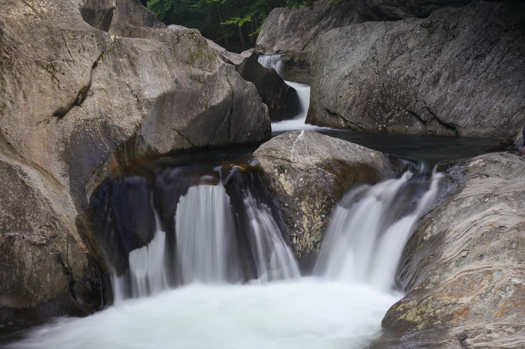
The 12 waterfalls with strong April flow
1. Arethusa Falls — Harts Location, New Hampshire
New Hampshire's tallest single-drop. The 140-foot cascade only shows its full scale with spring volume behind it. Trail from Route 302 is a 2.6-mile round trip; expect mud, some ice patches, and roots. The real view is Bemis Brook in spring, not August. No swim. Open the Arethusa Falls guide for parking and trail notes.
2. Moxie Falls — The Forks, Maine
90 feet of vertical drop. Short walk from the parking area off Moxie Road. Road is passable in a regular car through April. Spring is when the falls run wide instead of narrow. Bring warm layers, not a swimsuit. Open the Moxie Falls guide for access and timing.
3. Bash Bish Falls — Mount Washington, Massachusetts
The tallest waterfall in Massachusetts and one of the region's most dramatic twin-cascade drops. April flow from the Mount Washington State Forest drainage turns the split-cascade into a full curtain. Swimming is not permitted here at any time of year for safety reasons. Come for the view and the spray, then keep moving. Open the Bash Bish Falls guide.
4. Moss Glen Falls — Granville, Vermont
Route 100 roadside. Five minutes from parking to the falls. Spring doubles the visible tiers; by July you'll only see the lower cascade cleanly. Great for travelers doing a Route 100 drive from Waterbury to Warren. Open the Moss Glen Falls (Granville) guide.
5. Kent Falls — Kent, Connecticut
Connecticut's most-photographed waterfall, and the only month where every tier of the multi-drop cascade runs at full volume. State park access, small parking fee. Trail is paved and accessible to most people. Open the Kent Falls guide for entry fees and hours.
6. Enders Falls — Granby, Connecticut
Five separate drops in Enders State Forest. Third and Fourth Falls are the best in spring; they're thin streams by July. Free access, small parking lot that fills by 10 AM on warm weekends. Open the Enders Falls guide.
7. Bingham Falls — Stowe, Vermont
Short trail from Route 108 into a gorge. The pool at the bottom is cold-plunge territory in April (the water stays under 50°F into June here). Come for the gorge scale and the moss-polished walls. Open the Bingham Falls guide.
8. Glen Ellis Falls — Jackson, New Hampshire
Pinkham Notch, Route 16. A five-minute walk under the highway reaches the base of a 64-foot drop. Spring volume is powerful; keep kids back from the wet rocks at the overlook. Open the Glen Ellis Falls guide.
9. Screw Auger Falls — Grafton Notch, Maine
Route 26, just inside Grafton Notch State Park. A gorge carved from the Bear River with a 23-foot drop and potholes that fill dramatically in April. The park's main facilities may not be open yet, so verify current road and parking status before treating it as a sure stop. Open the Screw Auger Falls guide.
10. Doane's Falls — Royalston, Massachusetts
A series of four drops managed by the Trustees. Best in April when the brook runs high; by late summer the lower falls can nearly stop. Swimming is not allowed here. Open the Doane's Falls guide.
11. Stepstone Falls — Exeter, Rhode Island
Rhode Island's strongest waterfall window is usually April into May. Low cascading ledges across the Falls River in Arcadia Management Area. The flow is honest spring flow, which may not be the case in July. Dirt access road; drive slowly. Open the Stepstone Falls guide.
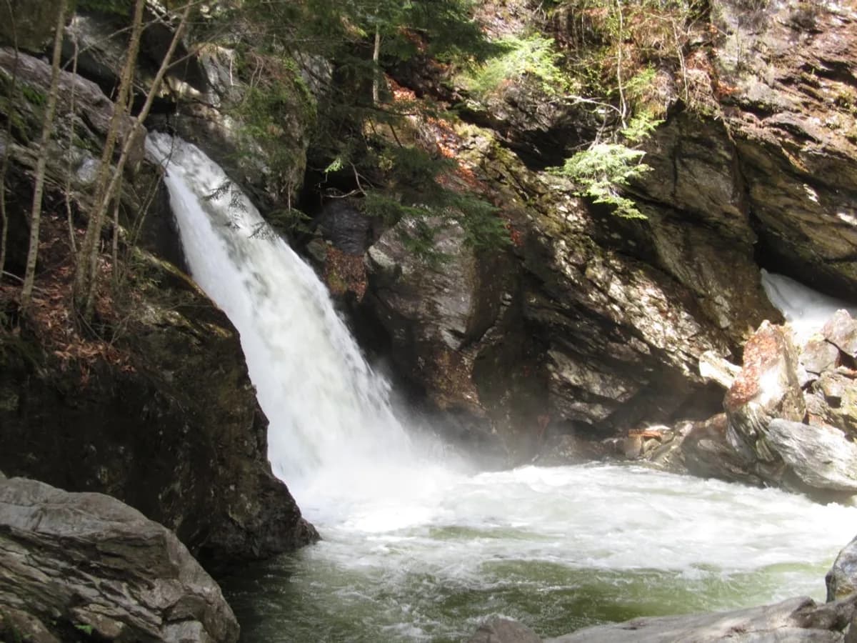
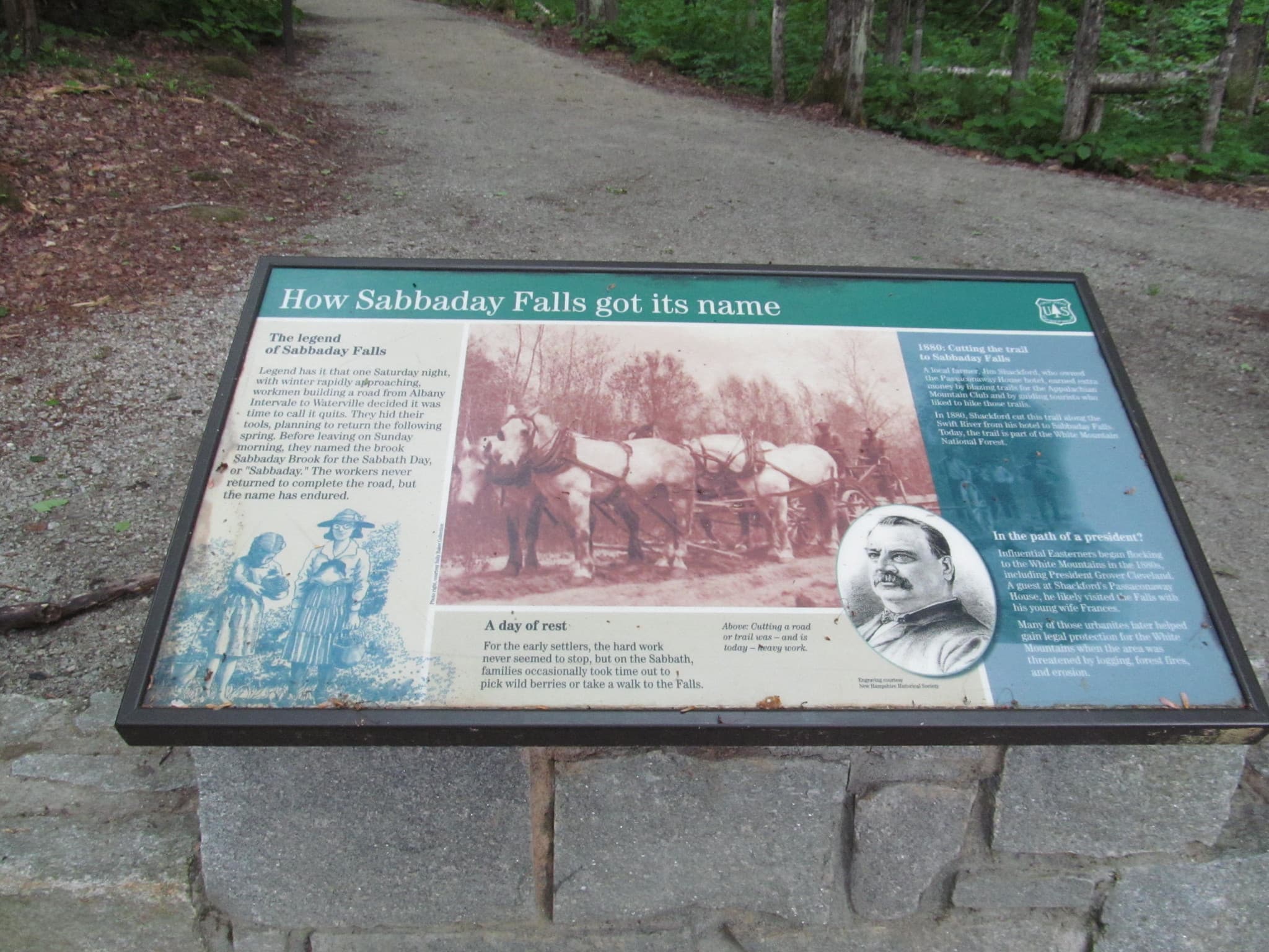
12. Sabbaday Falls — Waterville, New Hampshire
Kancamagus Highway, short paved walk, fully open in April. Snowmelt from the Sandwich Range turns the narrow flume into a roaring chute. Good combination stop with Rocky Gorge and Lower Falls on the same drive. Open the Sabbaday Falls guide.
What usually works best in April
- Pick short, low-elevation walks. Mountain trails still have frozen sections at higher elevations.
- Treat any waterfall pool as too cold to enter, even for a quick dip.
- Wear traction (microspikes or stud-boots) if you're visiting anything above 1,500 feet.
- Leave plenty of buffer between you and slick rocks. April ice-melt makes moss-covered ledges unusually slippery.
- Check the state's 511 road status before driving to anything in the Whites or the western Maine mountains.
Road and trail status by state (April 2026)
Vermont
Route 100 is the most reliable north-south waterfall drive. Gap roads and Smugglers Notch reopen on variable spring schedules, so check VTrans before building a loop around them. Mud-season advisories and closures affect sensitive Long Trail and Green Mountain routes; read current state notices. Use Vermont waterfalls for complete planning.
New Hampshire
The Kancamagus Highway and Crawford Notch usually remain open year-round, but spring storms and maintenance can still affect pull-offs. Check New Hampshire 511 and White Mountain National Forest notices before driving. Use New Hampshire waterfalls for full coverage.
Maine
Route 26 through Grafton Notch is usually the most practical April waterfall corridor in western Maine. Gate roads for more remote falls can stay closed into May, including Gulf Hagas access. Use Maine waterfalls for planning.
Massachusetts
Route 2 Mohawk Trail open year-round. Berkshires access reliable. Chapel Falls Trail (Chapel Brook Reservation), Tannery Falls, and Bash Bish Falls are good pins for April scouting. Use Massachusetts waterfalls for full list.
Connecticut
Many waterfall state parks have usable parking in April, but hours and gates can still vary by site. Kent Falls typically feels easier before the summer fee season. Use Connecticut waterfalls for planning.
Rhode Island
Arcadia Management Area is a strong April option when dirt roads are dry enough. Drive slowly after rain and use Rhode Island waterfalls for context.
A simple April planning order
- Pick a region within two hours of your starting point.
- Confirm the road is open (state 511 site or road status page).
- Check mud season trail closures for that region.
- Pick one main waterfall and one backup within 30 minutes.
- Bring layers, traction, and a towel you don't need for swimming.
- Go early. Parking at Kent Falls, Enders Falls, and Bash Bish fills fast on sunny weekends.
Before you go
- Water temperature is in the 40s, not the 60s. Do not swim.
- Spring current is deceptive. More water means more force, not just more volume.
- Wet rocks near falls are the single most dangerous surface in New England outdoors. Do not climb on them.
- Most April accidents are slips, not drownings. Traction and distance solve both.
- If access feels questionable or a road barrier is up, turn around and use the backup.
Related guides
- Memorial Day Waterfalls
- Mud Season Waterfall Trails Open in April
- Best Waterfalls for a Hot Summer Day
- One-Day Waterfall Road Trips
- When New England Swimming Holes Warm Up
FAQ
Which New England waterfalls are at their best in April?
Waterfalls fed by snowmelt and mountain drainage. Arethusa Falls in New Hampshire, Moxie Falls in Maine, Bash Bish Falls in Massachusetts, Bingham Falls in Vermont, and Screw Auger Falls in Grafton Notch all peak in April. These are the spots where the full scale of the drop only shows with spring volume.
Can I swim at New England waterfalls in April?
Don't. Water temperatures are in the 38–48°F range for most mountain-fed waterfalls. Current is faster than it looks from the bank. Even a quick slip in a gorge pool can cause cold-water shock within seconds. Treat April as a look-and-photograph season, not a swim season.
Is the Kancamagus Highway open in April 2026?
Yes, the Kancamagus is open year-round, so Sabbaday Falls, Rocky Gorge, and Lower Falls are reachable by car throughout April. Some trailhead pull-offs may still have packed snow and ice in the first half of the month. Check the New Hampshire 511 site before driving.
Are White Mountain waterfall trails open in April?
Some are, many aren't. The White Mountain National Forest has formal mud season trail closures on specific trails from April through mid-May to prevent damage. Franconia Falls, Arethusa Falls' main approach, and Glen Ellis Falls all have short access walks that are typically passable, but higher-elevation routes like Falling Waters are discouraged or closed.
Is the Grafton Notch road open in April?
Route 26 through Grafton Notch, Maine is open year-round. Screw Auger Falls, Moose Cave, and Step Falls access from Route 26 is reliable through April. Some trailhead facilities don't open until Memorial Day weekend.
Why do waterfalls run lower later in summer?
New England waterfalls depend on snowmelt, spring groundwater recharge, and consistent rainfall. Snow finishes melting by mid-May in most of the region, groundwater levels drop through June and July, and summer drought cycles can thin falls to a trickle by August. April is the highest-volume window for non-dam-fed waterfalls.
View the next guide
Updated June 1, 2026. Trail and road conditions change fast in mud season. Verify state 511 road status, park notices, and posted signs before driving.